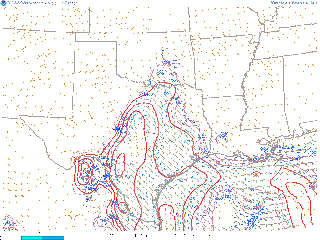
We begin tonight with an ever so small chance for an isolated tornado across southern Oklahoma and north Texas, near the I-35 corridor. The Storm Prediction Center just released this mesoscale discussion regarding the possibility. While there is a small chance for a tornado tonight, as hodographs and the low-level jet strengthens, tomorrow will be a higher severe weather impact day.
When we wake up in the morning showers and thunderstorms will likely be ongoing in parts of the area, mainly garden variety thunderstorms with heavy rainfall. Some large hail could accompany these storms, but the greatest threat will be later in the day. Depending on how quickly the showers/clouds move out of the area will determine just how violent tomorrow's storms will be. If the low clouds stick around throughout the day the significant severe weather threat will be lessened, but severe weather will still be likely. If the clouds/showers clear out earlier then the atmosphere will begin to quickly destabilize, thus increasing the threat for tornadoes and baseball size hail. Tomorrow will feature a deepening low pressure system, cold-front/dry-line, very high moisture content, and strong wind-shear. This setup will will likely cause significant severe weather, no matter how much or how little destabilization we get from clearing skies, that will pose a risk for strong tornadoes, baseball sized hail, and 70+ mph winds. The storms will likely be discrete supercells starting out, and then slowly transitioning into a squall line/MCS the further east the storms get. (With the discrete supercells expect tornadoes, large hail, and high winds. Once the storms merge into more of a squall line/MCS expect isolated tornadoes, large hail, and destructive winds.) The greatest chance for tornadoes appears to be from an OKC down to Abilene and just to the east.
The storms will blow through our area Monday night into Tuesday morning. Tuesday late morning will feature a decaying MCS in the eastern parts of the area, east of HWY 75. Right now it appears by mid afternoon, Tuesday, that the line will redevelop in extreme eastern Oklahoma and northeastern Texas; east of a Hugo to Bonham line. Once those storms redevelop a MCS will quickly form as they move eastward towards Arkansas.
Here are my thoughts as of tonight on the tornado threat, however, this could be fine tuned as we get closer to the event. All parts of Texoma are in the risk zone for the possibility of tornadoes Monday/Tuesday. Also, everybody needs to take the same measures to protect their lives and property with this severe weather event because all modes of severe weather can be and are deadly.
Along with the severe weather will be very beneficial rainfall with this system, most of the area will get over 1.00" of rainfall; some 3.00" amounts are possible as shown in this graphic.
Additional information:
Here is a look at the moisture surging northward tonight as the low-level jet strengthens.
Air-mass is already becoming unstable
**While Texoma Weather will post as many updates as possible tomorrow please check out nws.noaa.gov for lifesaving information as well**
http://www.srh.noaa.gov/oun/
http://www.srh.noaa.gov/fwd/


No comments:
Post a Comment