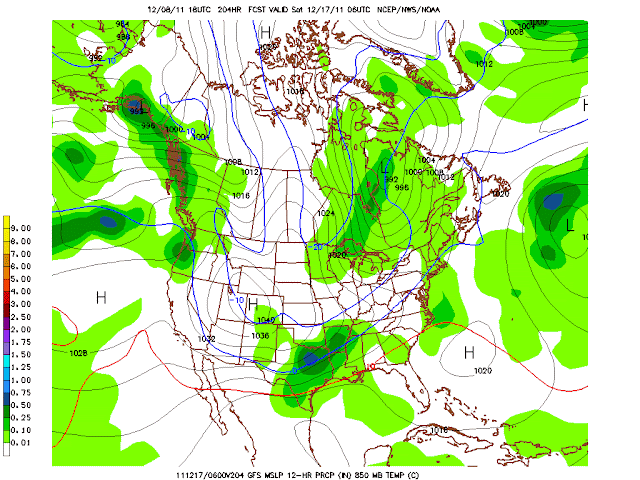
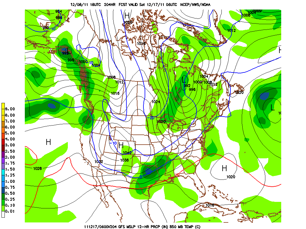
Our area is about to be in another active weather period next week. I'll start fist with tonight, locations south of I-20 could deal with some fog forming within the next few hours. Some of the fog could be dense, so be aware of that and also a few isolated locations could be at or slightly below freezing in that location; that would mean some bridges/overpasses could get slick. Now on to the weekend, our southern locations, near I-20, could receive some rain showers late Saturday into Sunday. Right now this does not appear to be too big of a deal, but we will keep an eye on the system as temperatures will be cold north of I-20 Sunday morning. (A few of the 00Z models are also showing moisture being pulled up into this system.) The next big weather system to impact us will be the Wednesday time frame; at that time a trough will move overhead causing widespread rainfall, especially in Oklahoma. The models are currently at a difference in regards to the exact track of the system, which will cause major differences to the forecast; the GFS is taking a southern track while the ECMWF is taking more of a northerly track. I'm leaning towards a system that tracks in between the GFS and the ECMWF are advertising. This event should be all rain with the possibility of a few thunderstorms, especially if more instability comes into play; Tuesday-Wednesday should be relatively mild too(60's). Right now it appears that locations across north Texas will see between .50-1.00", and in Oklahoma expect .75-1.25" of rainfall. (I'll continue to post frequent updates on storm track, and precip totals over the next few days as the track will become clearer in the next 48 hours.) Following the system will be a potent cold front which will drop temperatures and scour out the moisture late Wednesday night. Shortly after that system some guidance is suggesting a southern storm track interacting with the cold air in place following Wednesday night's cold front; we all know what that means! (Keep in mind this is several days out and details will change on the system, but it's fun to track just in time for the holidays; don't pay too much attention to the details, just to the trend of colder/wetter pattern arriving in the extended.) Here's what the 18ZGFS advertised.

Again I'm not forecasting this GFS scenario to come true, just showing you all what it's suggesting; we all know model runs this far out are junk, most of the time. Some really cold air could settle into our "neck of the woods" come late December. Temperatures over the weekend will range from the mid 40's, north, to the low 50's, south. While Sunday will be breezy with temperatures in the upper 40's, north, to the mid 50's, south. Lows will range from the mid 20's to upper 20's Saturday/Sunday morning, north, to the upper 20's lower 30's, south, on Saturday/Sunday morning.

No comments:
Post a Comment